
The Bush Camp at Faraway Bay is a remote tourist facility with low impact infrastructure featuring the unique environment of the Diamond Coast of the East Kimberley. The activities at the complex are run by Bruce and Robyn Ellison, who were concerned that Striker Resources, a diamond miner, had proposed a barge landing site and associated road in Gumboot Bay adjacent to Faraway Bay which, they believe, would adversely impact their environment, spoiling the serenity and solitude for their guests. In addition, Striker Resources had written to the Ellisons expressing concern that their water was being piped from a creek in which there was significant Aboriginal paintings, although the source of this information was not made clear.
As several people with differing environmental and archaeological expertise were to be in Kununurra at the end of April and early May for an Environmental Fire Conference, Bruce and Robyn Ellison extended invitations to the authors of this report, as well as to people with expertise in environmental accountancy, zoology and vegetation analysis to visit Faraway Bay in order to evaluate the cultural and environmental value of their location. It was also hoped that this could lead to additional research projects being undertaken with Faraway Bay being used as a base, subject to discussions with Conservation and Land Management and other vested groups.
Over three days, 24-26th April 2001, as part of the overall research team response, the above authors in and around Faraway Bay undertook preliminary archaeological and Aboriginal cultural heritage surveys.
The main areas of investigation were:
The creek from which water is piped, and which was reported to contain significant Aboriginal sites;
The ridge on which the road runs from the airstrip to Faraway Bay (part of the Ellison's lease) and along part of which Striker plans to build its access road; and
The main creek and gorge which runs into Gumboot Bay.
The eastern side and top of the ridge which follows the main creek into Gumboot Bay
One of us Burriwee (Ju Ju Wilson) is a Miriuwung woman with traditional links to the area through her paternal grandfather. Prior to our visit to Faraway Bay Ju Ju had expressed some concern that perhaps some of the Ballangarra people may not realize the importance of the area extending from the King George Falls to the Faraway Bay Coastline and wished to be part of the archaeological team to look for herself.
Methods
Faraway Bay Creek and Gorge
The creek from which water is piped to Faraway Bay was surveyed for any evidence of Aboriginal cultural heritage. Access to the head of the gorge was via the Ellison's road and then on foot. The gorge at the head of the creek was examined and each location, which was likely to contain art of archaeological deposit, was inspected.
The bed of the creek was then followed down to the start of the Faraway Bay water pipeline, and the pipeline was followed along the creek through the mangroves and onto the beach adjacent to the Bush Camp. All evidence of Aboriginal occupation, as well as potential resources, was recorded.
Access Road Ridge
The ridge along which the Ellison's road runs from the airport to the Bush Camp was also surveyed from the point of intersection with the proposed Striker road. The length of the ridge was walked to a point in Gumboot Bay near where the barge landing facility is planned. At this point, a boat picked up the party.
Gumboot Bay Creek, Gorge and Eastern Ridge Top.
Access was from the Ellison's Road. The flat ridgetop was traversed on foot to a point approximately 200 meters downstream from the major waterfall, which is located at the head of the gorge. The creek leading into Gumboot Bay contains a number of large permanent waterholes, which would have been attractive to Aboriginal people. To maximize the coverage, the party divided into two, with one group walking back to the waterfall and then along the length of the creek near the top of the ridge. Sections of the ridge top extending approximately one hundred and fifty meters into the country east of the ridge top was surveyed, and where there was evidence of rock overhang leading down into the creek, this was surveyed also. The second group walked along the creek. The two groups came together at the last large waterhole above the junction with the salt, and were picked up by boat.
RESULTS
Faraway Bay Creek and Gorge
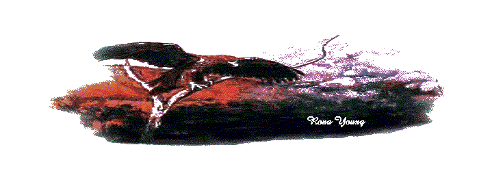
Four rock art sites were identified near the head of this creek, all on the eastern side and within approximately 100 meters of each other. The largest site consisted of a large gallery of human figures of the "Bradshaw" type, ranging in size from approximately 15 cm to two large figures approximately 1 m high. Others figures included patterns typical of the "Bradshaw" infill phase, but there were also several kangaroos drawn in different styles which overlapped. Also of interest was a drawing of a quadruped animal with a short tail and a long, almost giraffe-like neck. Given the suggested age of this style of painting as being perhaps 20,000 years old or even older, it is difficult to determine what this animal might be. It is certainly not a dingo, thylacine of other animal, which may have been present in the region within the last 10,000 years. It could represent one of the extinct diprotodontid forms, which are known to have occurred in the Kimberley more than 20,000 years ago. An Aboriginal lady now living in Kununurra found a partial skeleton identified as Zygomaturus, and it is not inconceivable that the drawing represents this animal.
There are four stages of superposition of paintings, all of red ochre with the exception of a small abstract painting, painted in white ochre.
Many of the "Bradshaw" style figures have been destroyed by pecking, a phenomenon typical of this art form in other parts of the Kimberley.
Cupule indentation found in site 2 indicate some patterning, which suggests a ceremonial purpose, perhaps an increase ceremony for a food resource. Ochre splotches also found in one of the sites may indicate this purpose also. Archaeologically, both indicate substantial age. The cupule's had a fine silica buildup, and the paint splotches had become almost part of the rock.
None of the rock art found in any of the four shelters suggests recent retouch. Some evidence of the contact phase of white ochre painting was found in one of the shelters, but the state of preservation indicated this probably resulted from initial contact, rather than later. It was in a fairly sheltered section of the site and there was little evidence of frequent fires through the area, one of the main proponents for stimulating rapid deterioration of the rock art. Without exception, the majority of the rock art images found in all four rock art shelters had become part of the rock, with little evidence of ochre remaining on the rock surface.
The range of stylistic variation and detectable superimpositioning of motifs etc suggest the sites may have changed in perception of use, and perhaps been used by more than one cultural group over time. The archaeological evidence generally suggests it is some time since these rock art sites have been used by Aboriginal people, probably since initial European contact.
Access Road Ridge
Shell middens extending over several hundred meters along the ridge were located where the Striker road is to run. Evidence of middens extended right down to the proposed barge-landing site. At least four species of shell were identified, as well as a considerable range of basalt stone tools of the type used to exploit the shellfish.
Gumboot Bay Creek and Gorge
A full survey some 150 meters above the main waterfall and surrounding area indicated no archaeological evidence of Aboriginal activity in the area. The very obvious overhang east and immediately adjacent to the falls, and overlooking the permanent waterhole below the falls, was investigated only after it had been determined there was no archaeological evidence of Aboriginal activity around and above the perimeter of the falls.
Two areas of intense painting activity were determined. A panel of Bradshaw type figures dominated one panel, and a separate panel some five meters south, consisted of ceremonial 'ulu' type anthropomorphic figures, one six fingered hand stencil, and a stenciled Woomera shape.
Both the Bradshaw like painted panel and the 'perhaps' later panel of figures and motifs suggests, archaeologically, it has been a long time since any Aboriginal activity or repainting has taken place at the site. All the art has become part of the rock, with little evidence of ochre on the surface. Much of the rock ledge used by the painters to reach the areas to paint the motifs had largely fallen away.
The motifs and stylistic variation on both panels are suggestive of ceremonial function. This is supported by the lack of evidence of Aboriginal activity in and around and above the site area.
The next site indicating Aboriginal activity was located almost a kilometer and a half north from the 'waterfall site', closer to the barge landing site. From this point on, lithic scatters and one other rock art site was located, indicating general Aboriginal activity commenced approximately one and a half kilometers from the 'significant' waterfall site. This evidence of Aboriginal activity, that is, open camping and living sites, in and around Gumboot Bay, was supported by the presence of the immense midden sites found along the proposed barge landing access road.
Although the specific meaning of the site appears to be lost, Burriwee felt this had been a very significant area, and probably a men's site, with family camping and waiting in the immediate area referred to as Gumboot Bay. ( Burriwee. pers. com.) This and the lack of archaeological evidence around and above the waterfall site suggest Burriwee's earlier comments were valid. The archaeological evidence on its own support the site as being 'significant'.
DISCUSSION.
Faraway Bay Creek and gorge.
The rock art sites located in the Creek and gorge were some one hundred meters south of the Faraway Bay water pipe, and without exception, located high along the ridge. No sites were found in the gorge itself. All sites were archaeologically determined as having had no Aboriginal activity for some time, possibly since European contact. The Bradshaw style rock art indicates three of the sites were probably several thousand years old. The ochre had largely become part of the rock itself, and with the exception of the white ochre motif, all motifs showed no evidence of surface ochre, indicating it is possibly thousands of years since any general retouching or repainting has been undertaken.
Gumboot Bay.
It is evident from this very preliminary archaeological survey that little or no previous work had been undertaken in the proposed barge landing site and adjacent area. Several substantial shell middens and open living sites were found along the proposed access road and on the immediate beach area. Of more significance is the presence of the obviously 'important' site found at the base of the falls feeding into the main gorge leading into Gumboot Bay. The archaeological evidence generally suggests the whole of Gumboot Bay, at one time, was extremely important to Aboriginal people living in the immediate area. The presence of what were, and still are today, obviously permanent fresh waterholes along the main creek feeding into Gumboot Bay, played a significant role in determining previous Aboriginal activity in the general area.
RECOMMENDATIONS
Gumboot Bay Creek and Gorge, and Access Road Alignment.
Aboriginal sites are protected, so for legal as well as aesthetic and cultural reasons, it is in the best interests of all parties to ensure that the sites are not impacted by development. Given the proposed development outline of the Striker barge landing site and the construction of the proposed access road, it is not possible that any development could be carried out without having a high impact on the cultural sensitivity of the area. Aboriginal people of the Kimberley need to have this physical reminder of the culture recorded, and where possible, preserved.
Recommendation 1.
No development should take place without further consultation with the descendants Of the area. This should be undertaken with Buriwee present, and every effort should be made to produce an opportunity for the descendants of the traditional owners of the area to walk over the proposed development area.
Recommendation 2.
No development should be undertaken until a full and complete archaeological investigation is undertaken. The preliminary investigations indicate the area is especially rich both archaeologically and culturally, and every effort should be made to ensure none of this information is lost.
Faraway Bay Creek and Gorge.
Recommendation 1.
That these sites be protected from the impact of wild fires in the future. They are all located in a very vulnerable location. It is suggested that Faraway Bay could take on a proactive role in ensuring the sites are looked after and protected from fire.
Recommendation 2.
That Faraway Bay continues to use the gorge for their water supply. Their continued presence and activity in the area, and the need to protect their water resource, ensures the vicinity surrounding the sites is also looked after. This acts as an added assurance for the descendants of the area who are very concerned that there is something left for future generations.